~~ Rivajenos ~~
(click on the picture for a larger view)
The port to the high plains – This formation provided a gentle slope down from the High Plains / Llano Estacado of Texas into New Mexico. It was one of just a few places that provided a way for the Comancheros to travel with their carts. This Caprock traverse was apparently use a lot. It is often talked about in the journals, conversation accounts and other historical records.
(click on the picture for a larger view)

When scanning satellite photos and topographic maps of the Caprock one can easily see that this is the best location to use for carts. If you have traveled along I-40 looking south one can quickly understand that there are very few opportunities to even ride a horse down the Caprock. Rivajenos is 9 miles to the north-north-west of Garcia Lake. From this view you can see the faded imprints of the trail running back towards Garcia Lake.
(click on the picture for a larger view)
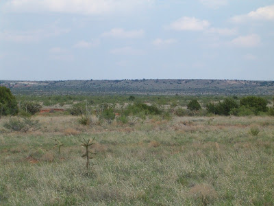
In the spring of 2006 we had the opportunity to tour the area of Rivajenos. Below are some pictures from that trip.
(click on the pictures for a larger view)
The slope down Rivajenos.

Looking up the slope.

Looking up one of the trails.

Looking down one of the trails.

Looking down another trail.

Looking down another trail.

Here is the remains of an Indian Tepee circle.

View from about 1/2 mile away looking up.

View from about a mile away.
.................................


No comments:
Post a Comment